
Flooding is one of the most financially destructive forces that can affect a property investment in Nigeria.
A plot that sits in a flood zone loses value progressively over time. Development on flooded land becomes expensive and structurally compromised. Tenants leave flooded properties quickly and do not return easily. Insurance costs rise significantly for flood-affected assets.
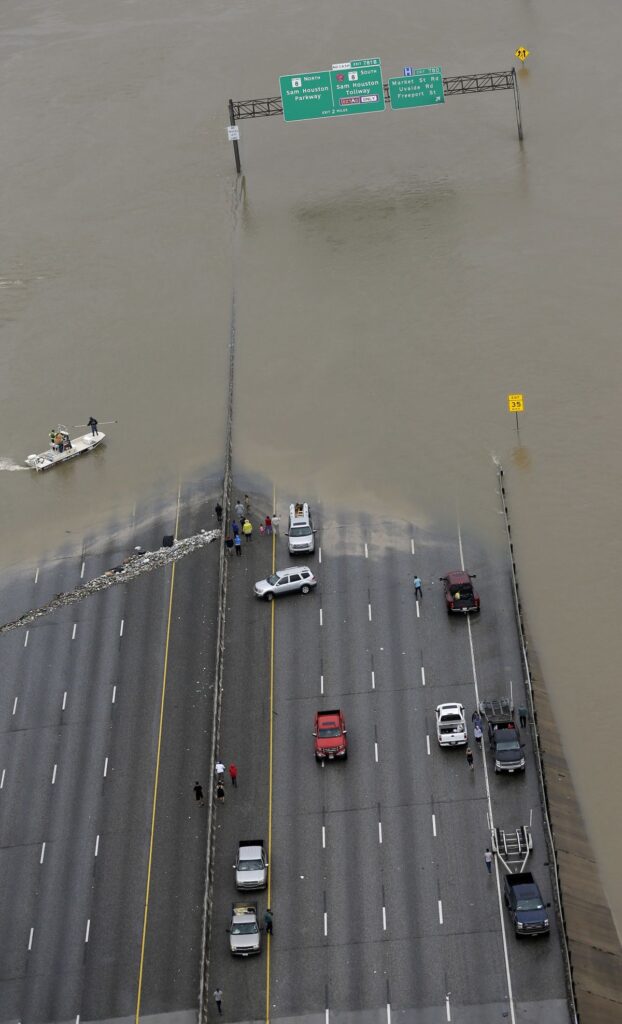
The most painful aspect of flood zone investment is that the risk is almost always identifiable before purchase. Buyers who lose money to flooding rarely encountered a situation that was genuinely undetectable. They encountered a situation they did not know how to detect. This article gives you the tools to detect it clearly.
The Definition Every Buyer Needs
A flood zone is any area that has a measurable probability of experiencing flooding during a defined period. Flood zones are classified by risk level. High-risk zones flood frequently and severely. Moderate-risk zones flood occasionally under specific conditions. Low-risk zones flood rarely but are not entirely immune.
In Nigeria, flood zone classification is managed by the Nigeria Hydrological Services Agency, commonly called NIHSA. This agency maintains data on flood-prone areas across the country. Their annual flood outlook reports identify states, local government areas, and specific communities facing elevated flood risk each year.
Why Nigerian Urban Flooding Is Different From Rural Flooding
Urban flooding in Nigerian cities operates differently from river flooding in rural areas. Urban areas have large proportions of impermeable surfaces including roads, rooftops, and paved areas.
These surfaces prevent rainfall from soaking into the ground naturally. Water that cannot enter the ground runs across surfaces rapidly and accumulates in low-lying areas.
Cities with inadequate storm water drainage infrastructure experience urban flooding even during rainfall that rural areas with permeable soil absorb without difficulty. Enugu’s elevated topography and natural drainage gradients give it a significant advantage over cities like Lagos that sit on low-lying coastal and swampy terrain.
Why Nigerian Urban Flooding Is Different From Rural Flooding
NIHSA publishes annual flood outlook reports that are available online and through their official channels. These reports identify specific areas at high, moderate, and low flood risk across Nigeria.
Checking the NIHSA flood outlook for the state and local government area where your target plot sits is the most authoritative starting point for flood risk assessment.
Visit the NIHSA website and search for their most recent annual flood outlook. Identify the section covering Enugu State. Note the specific local government areas classified at each risk level. Compare this classification against the location of the land you are considering purchasing.
Your property lawyer can assist with this search and interpret the technical language in the flood outlook report in the context of your specific purchase decision.
National Emergency Management Agency Records
The National Emergency Management Agency, known as NEMA, maintains records of flood events and disaster responses across Nigeria. These records include the locations of significant flood events in previous years and the communities affected by them.
Searching NEMA’s public records for flood event history in the area surrounding your target plot gives you a historical picture of flood frequency and severity. An area with multiple recorded flood responses in NEMA’s history is telling you something important about its drainage reality that no dry season site visit reveals.
Enugu State Ministry of Environment Records
The Enugu State Ministry of Environment maintains records and assessments of environmental conditions across the state, including drainage and flood risk information relevant to specific areas.
Making a formal inquiry through this ministry, ideally through your property lawyer, can produce specific information about the flood risk classification of your target area within the state’s own environmental assessment framework.
Using Technology to Assess Flood Risk
Google Earth Historical Imagery
Google Earth maintains satellite imagery taken at different times throughout the year across multiple years. This historical archive is one of the most practically useful tools available to any property buyer assessing flood risk.
Navigate to Google Earth Pro on your computer. Search for the location of the land you are inspecting. Access the historical imagery function by clicking the clock icon in the toolbar.
Scroll through images taken during rainy season months between June and September across multiple years.
Imagery taken shortly after heavy rainfall reveals whether the land retains standing water, shows darkened soil patterns indicating saturation, or displays visual evidence of surface flooding.
A plot that appears dry in January but shows visible water accumulation in August satellite imagery is communicating its flood risk through documented visual evidence.
Terrain Analysis Tools
Google Earth’s terrain view displays elevation contours that reveal the topographic position of any piece of land relative to its surroundings. Accessing this view allows you to assess the drainage basin position of your target plot without visiting the site.
Switch to terrain view in Google Earth and zoom into the area surrounding the land you are assessing. Observe the elevation contours carefully.
A plot sitting at the bottom of a visible depression in the terrain receives runoff from every surrounding higher area during rainfall. This topographic position is the single strongest predictor of flood risk available through remote assessment.
Several additional online platforms provide flood risk mapping for Nigerian locations. Global flood risk databases including the Global Flood Database maintained by international research institutions include Nigerian data that is accessible freely online.
Searching these databases for your specific location provides internationally standardized flood risk data that supplements the Nigerian government sources described above.
OpenStreetMap and Infrastructure Mapping
OpenStreetMap is a freely accessible online mapping platform that shows detailed infrastructure information including drainage channels, waterways, and natural water features in Nigerian cities.
Searching for the area surrounding your target plot on OpenStreetMap reveals the presence of rivers, streams, drainage channels, and other water features that influence flooding in the area.
A plot that sits close to a natural waterway, drainage channel, or seasonal stream is more exposed to flooding risk than one that sits at a distance from these features.
The OpenStreetMap data allows you to identify these water features and assess their proximity to your target plot before your site visit, allowing you to arrive at the inspection with specific questions about how the land relates to nearby water features.
Physical Signs of Flood Risk During Site Inspection
What to Observe at Ground Level
A site inspection conducted with flood risk awareness produces information that a general inspection misses entirely.
Specific physical signs at ground level reveal drainage history and current flood risk that technology-based assessment cannot capture with the same precision.
Walk the entire perimeter of the plot and observe the ground surface carefully. Look for the following specific indicators:
Watermarks on tree trunks, fence posts, or structural elements at the plot boundary show how high water has reached during previous flood events. A watermark fifty centimeters above ground level on a fence post tells you definitively that the plot has experienced flooding that deep in the past.
Soil color and texture at the surface reveals drainage history. Dark, almost black soil that feels unusually soft and moist underfoot during dry season indicates land that retains water far longer than well-drained soil does. This moisture retention during dry season indicates that the soil remains saturated throughout much of rainy season.
Sediment deposits visible on the surface indicate that water carrying suspended particles has flowed across the plot and deposited those particles as it slowed and settled. Fine, silty deposits on the surface of a plot that is not near any construction activity indicate flood-carried sediment from previous inundation events.
Erosion channels, even small ones, running across the plot reveal the direction and force of water movement during rainfall. Tracing these channels shows you the path water takes across the plot and reveals the point at which it exits or, critically, the point at which it has no exit.
Talking to Neighbors and Community Members
One of the most underutilized sources of flood risk information available to any property buyer is the community of people who already live near the land being considered.
Neighbors, market traders, roadside vendors, and residents of the immediate area have firsthand knowledge of flooding history that no satellite image or government document captures with the same specificity and reliability.
Ask direct questions of anyone you encounter near the land during your site inspection. Ask how the area behaves during heavy rainfall. Ask whether the road becomes impassable during rainy season. Ask whether any nearby plots have experienced serious flooding in recent years. Ask how long standing water typically persists after significant rainfall.
People who live with the drainage reality of an area have no incentive to misrepresent it to a stranger asking genuine questions. Their answers consistently provide the most accurate and specific flood risk information available to any buyer conducting due diligence.
What Enugu’s Geography Means for Flood Risk
Enugu’s topography provides a natural advantage that cities built on coastal plains or river flood plains simply cannot replicate. The city sits on elevated ground within the hilly terrain of Southeast Nigeria. Its natural slopes create gradient that moves water away from residential areas rather than collecting it.
This natural topographic advantage means that well-located plots in Enugu’s established and developing corridors face fundamentally lower flood risk than comparable plots in cities whose geography works against drainage.
The natural drainage gradient of Enugu’s terrain supplements the engineered drainage infrastructure that responsible developers install within their estates.
The Prideland in Golf Annex Phase 2 benefits from both of these advantages simultaneously. Enugu’s natural topography provides the broader drainage gradient that moves water through the area.
The estate’s dedicated drainage system manages water at the community level. Together they create a flood risk profile that is among the most favorable available to any property buyer in Southeast Nigeria.
The Wealthy Place near Centenary City, Royal Court Apartments, the Transmission Company of Nigeria at Ugwuaji, and Primary Health Centre Obeagu sits in a corridor where the institutional and residential development surrounding the estate reflects confidence in the area’s environmental conditions. Established institutions do not locate in flood-prone areas.
Applying Everything You Have Learned
Creating Your Personal Flood Risk Assessment
A complete flood risk assessment before any land purchase combines the government resource checks, technology-based analysis, and physical site inspection indicators described in this article.
No single element of this assessment is sufficient on its own. The combination of all of them produces a picture of flood risk that is reliable enough to protect your investment decision.
Before committing to any land purchase in Nigeria, complete the following checklist:
Check the NIHSA annual flood outlook for the relevant local government area. Review NEMA historical records for flood events in the surrounding community. Examine Google Earth historical imagery taken during rainy season months.
Assess the terrain view in Google Earth for the topographic position of the plot. Search OpenStreetMap for waterways and drainage features near the plot. Visit the site and observe physical flood indicators at ground level. Speak with at least three community members or neighbors about local flooding history. Ask the developer specific questions about the estate’s drainage infrastructure and its outlet.
A plot that passes every element of this assessment is a plot whose flood risk you have genuinely evaluated rather than simply hoped was acceptable.
Royal Garden and Resort, Viva-Gold Real Estate’s flagship resort-style development, is designed with environmental quality as a fundamental element of the community vision.
The development planning for this estate accounts for drainage and environmental management at a standard consistent with the resort-quality living experience that the development promises its residents and investors.
Your Investment Deserves This Level of Care
Flood zone risk is entirely assessable before purchase. Every tool and technique described in this article is accessible, free or low-cost, and practical for any buyer willing to invest the time the assessment requires.
The buyers who lose money to flood zone investments are not generally unintelligent or careless people. They are people who did not know what to look for and did not have the practical guidance this article provides. Now that you have this guidance, the responsibility to apply it before any purchase rests entirely with you.
Viva-Gold Real Estate builds flood risk management into every estate they develop in Enugu. Their drainage infrastructure, their location choices, and their documentation standards all reflect the understanding that a protected investment starts with a properly assessed, properly drained, properly documented plot of land.
+234 813 221 5202 | +234 901 001 0160, info@vivagoldrealestate.com, vivagoldrealestate.com | 7 College Road, New Layout, Enugu